GEOID18 Map Gallery
This page provides high resolution images of GEOID18 maps showing geoid values, changes from GEOID12B, improvements in the model, estimated uncertainties, and the GPSonBM data that was used to make the model. To interact with and investigate these images and data further, visit the GEOID18 Exploratory Web Map.
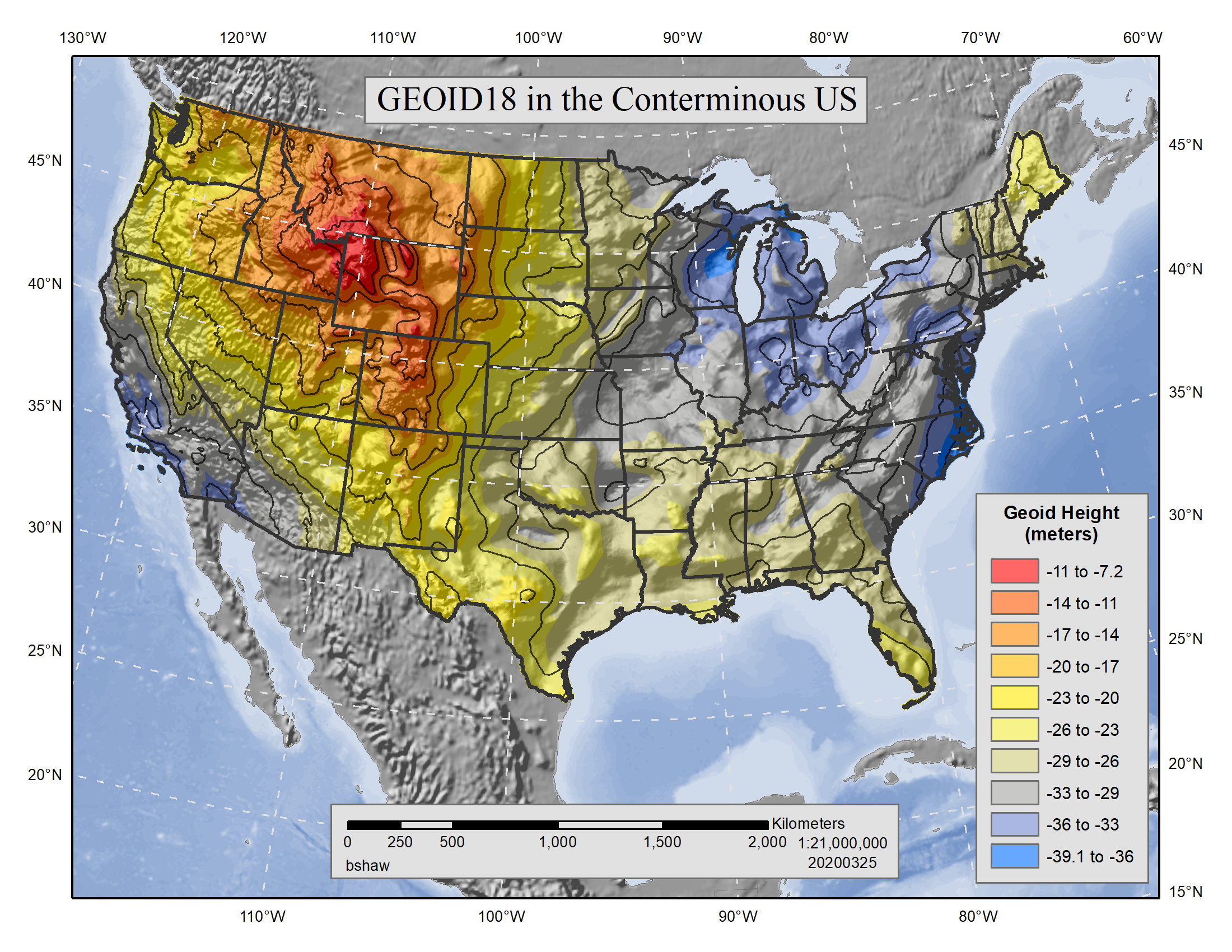
GEOID18 in CONUS |
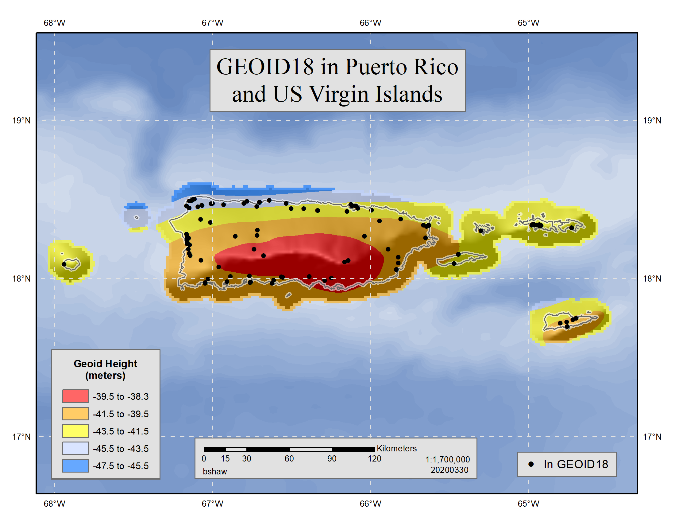
GEOID18 in PRVI |
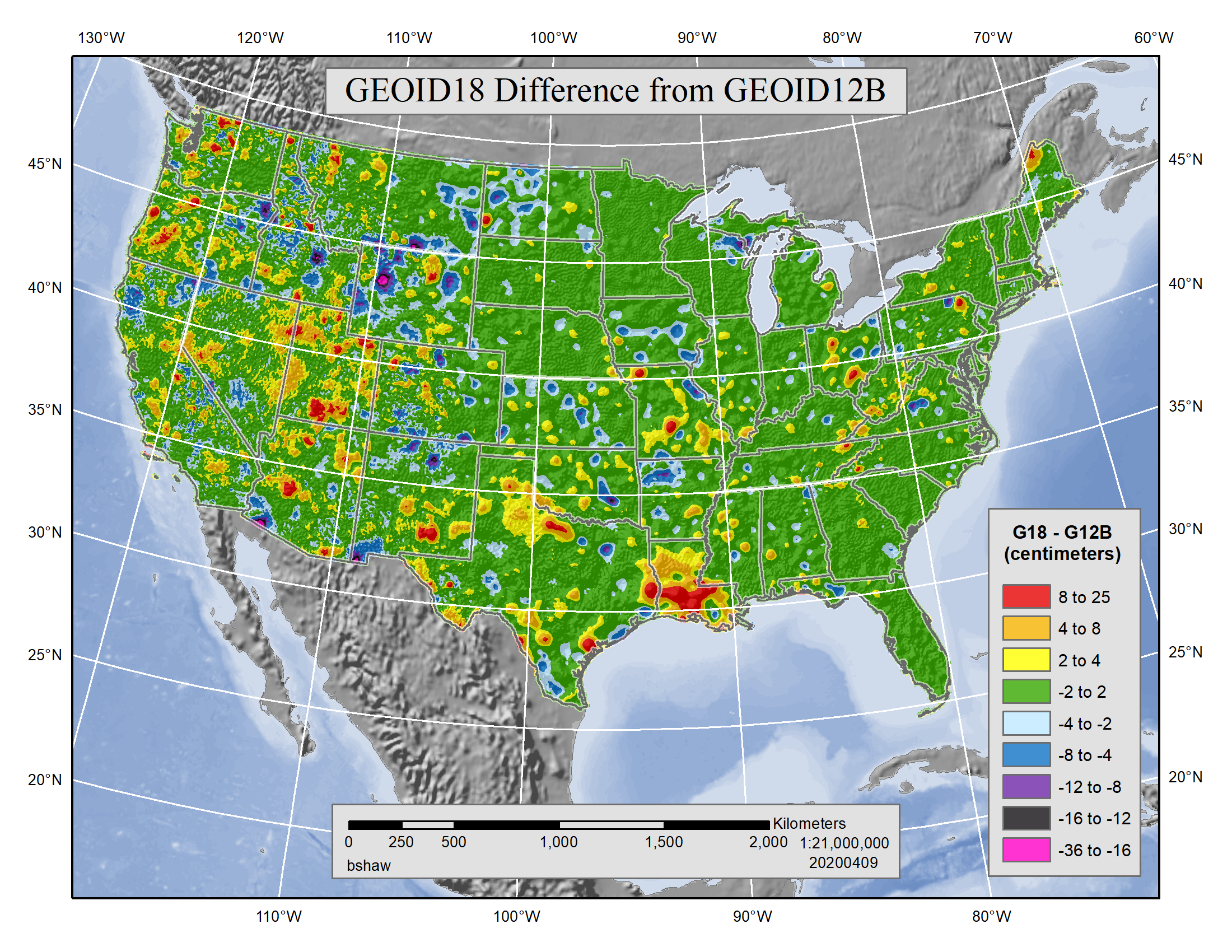
Difference between GEOID18
|
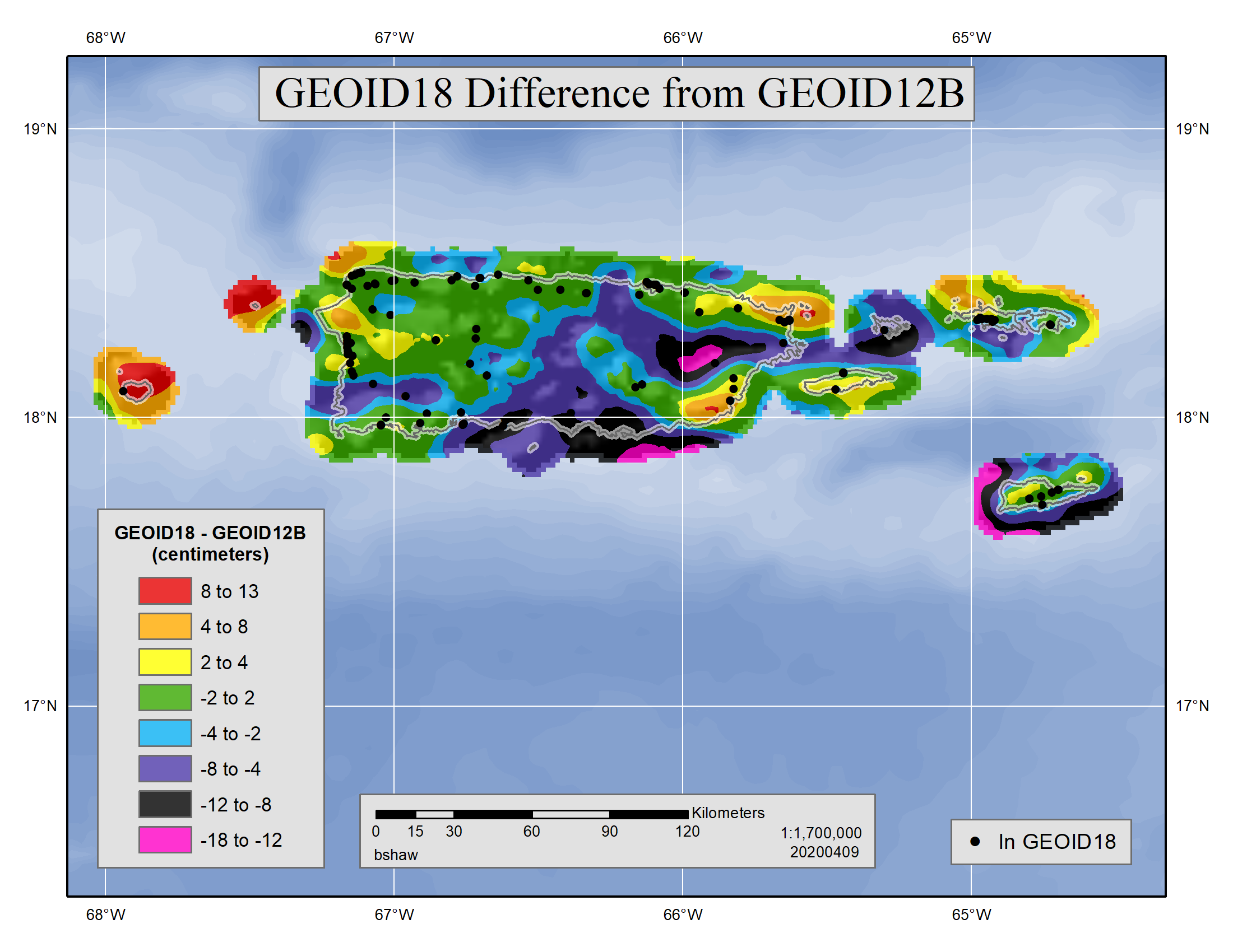
Difference between GEOID18 and GEOID12B in PRVI |
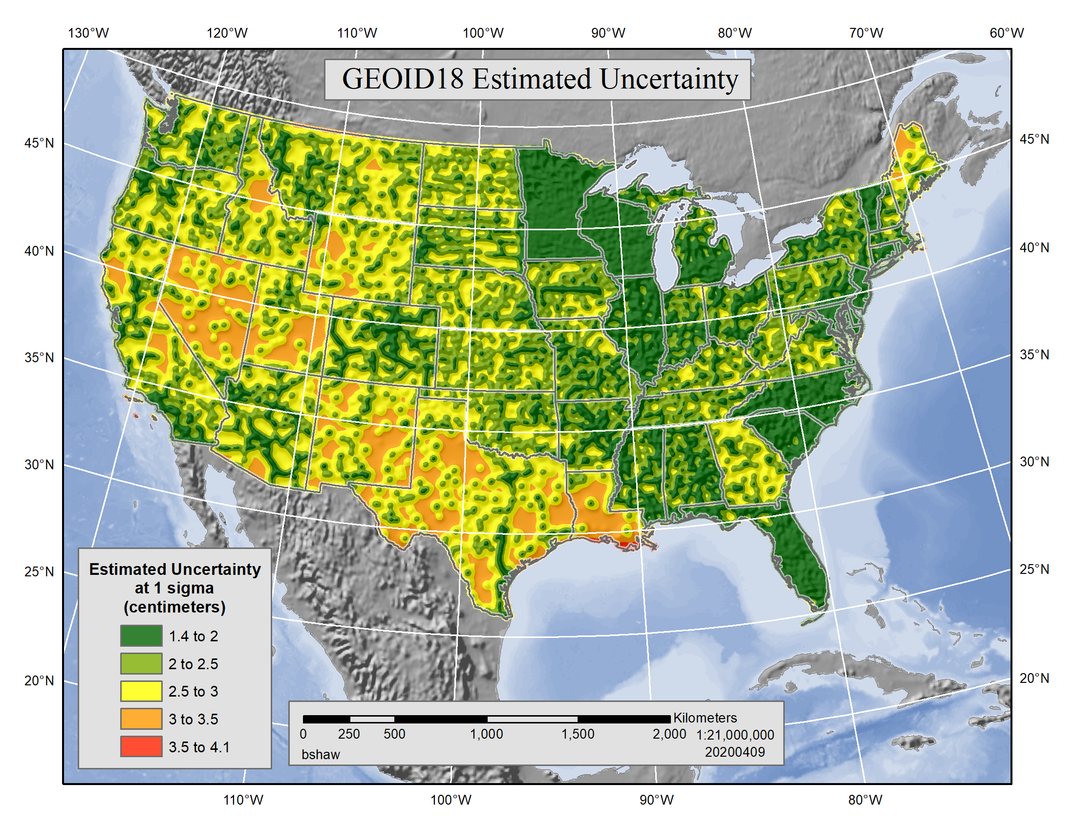
GEOID18 Estimated Uncertainty for CONUS |
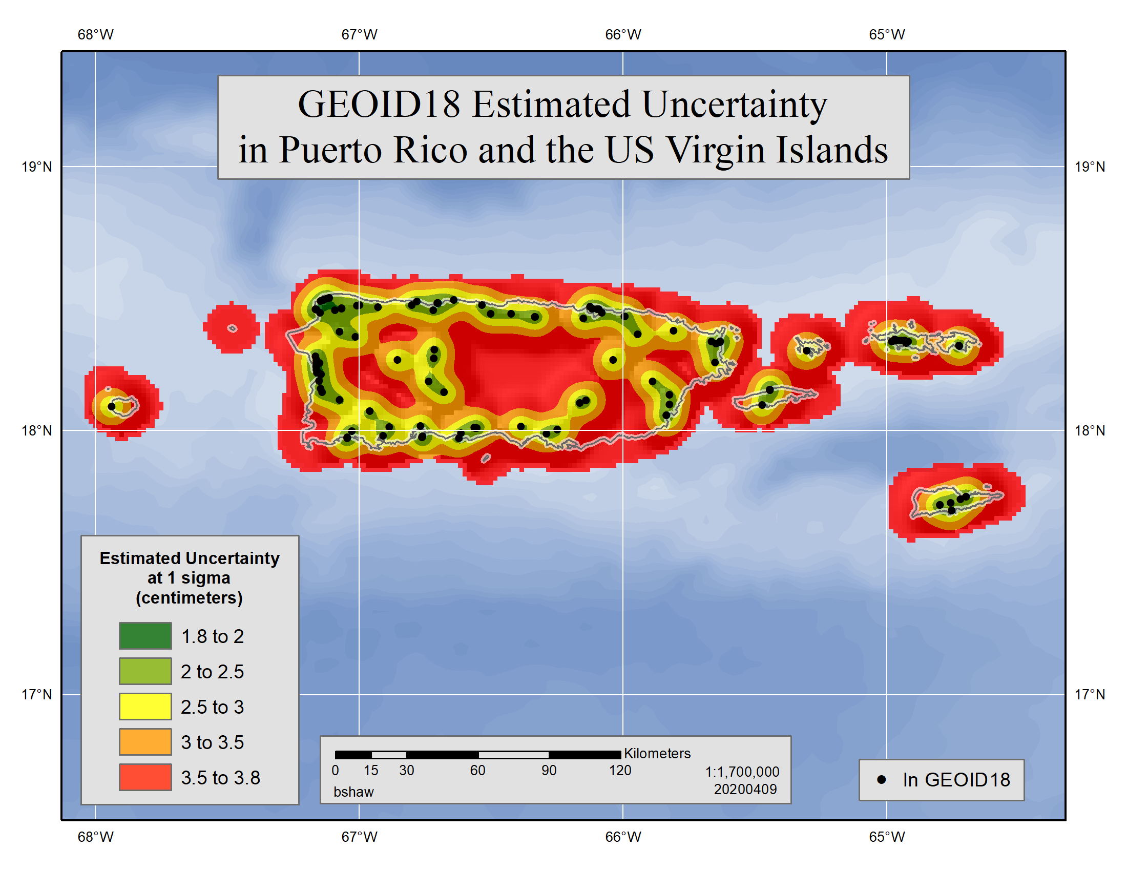
GEOID18 Estimated Uncertainty for PRVI |
GEOID18 Improvements CONUS |
GEOID18 Improvements PRVI |
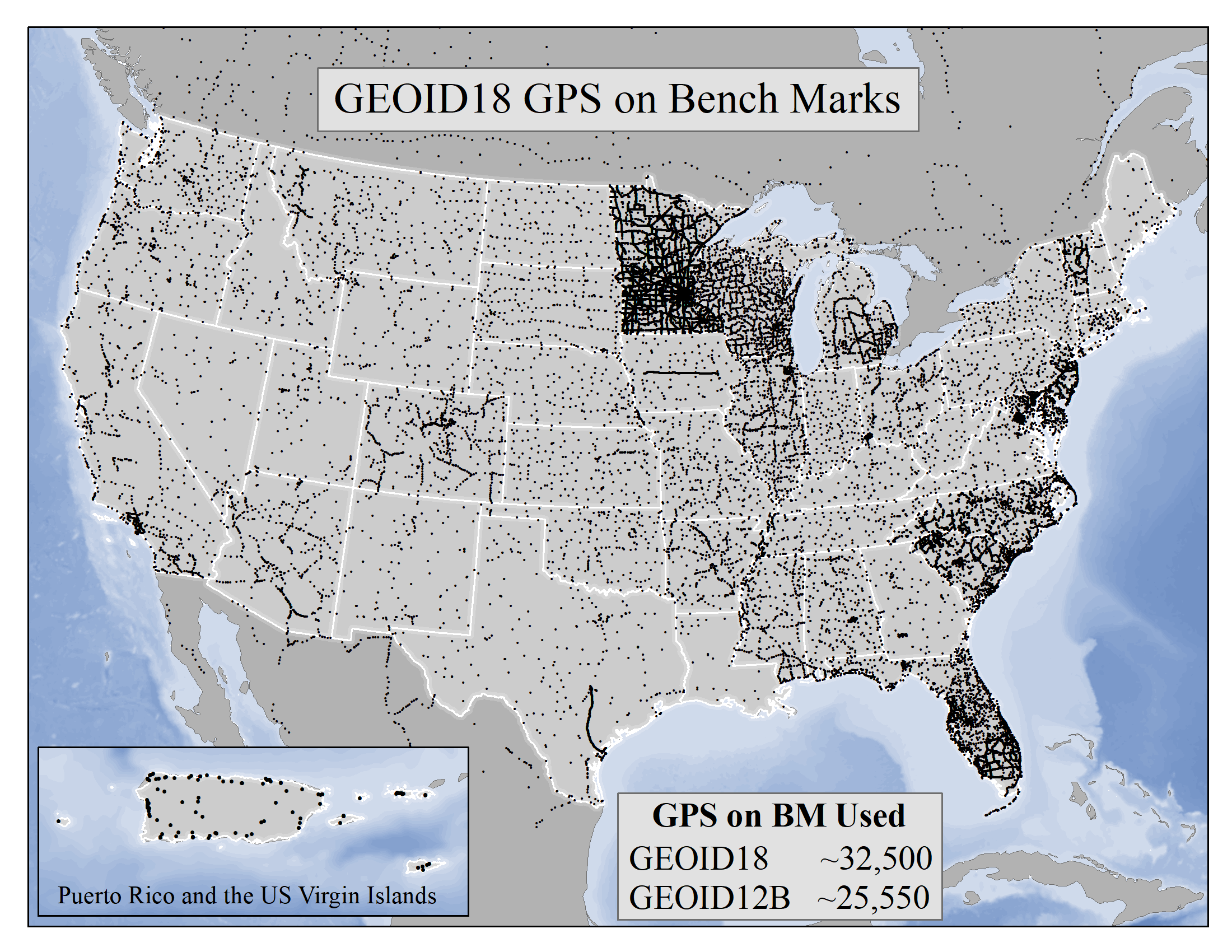
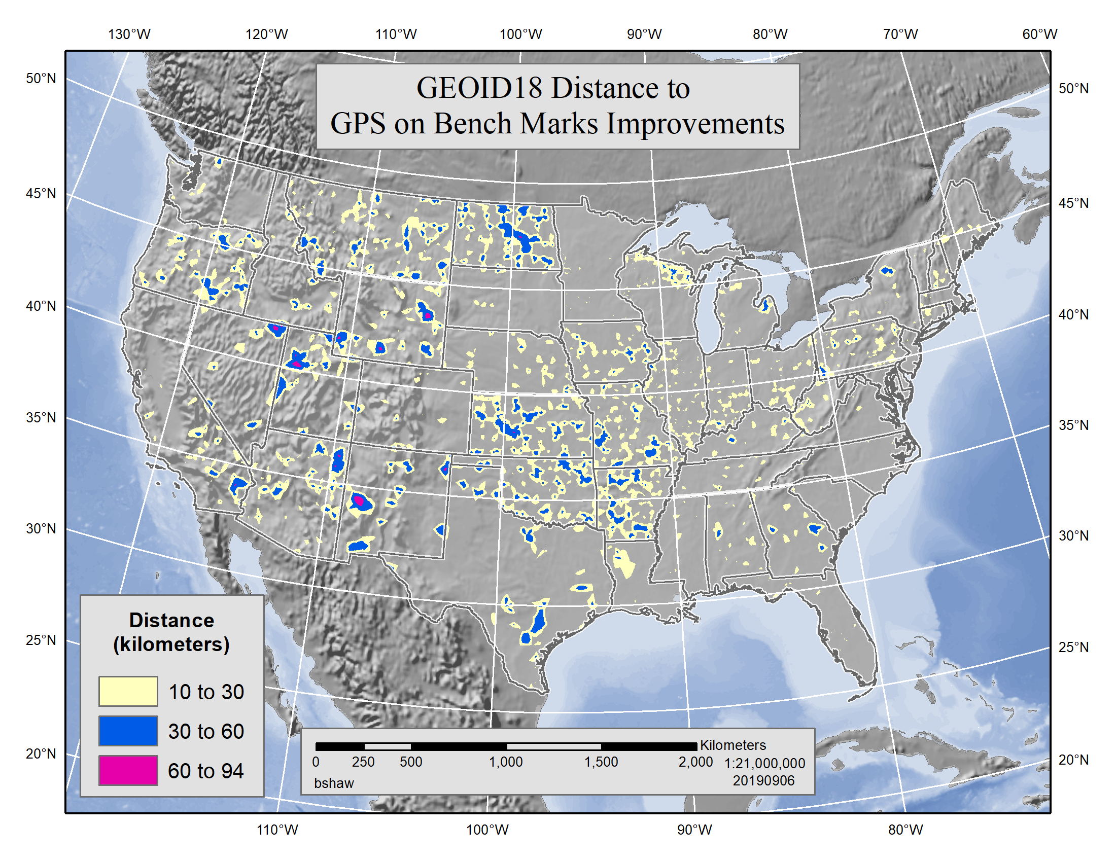
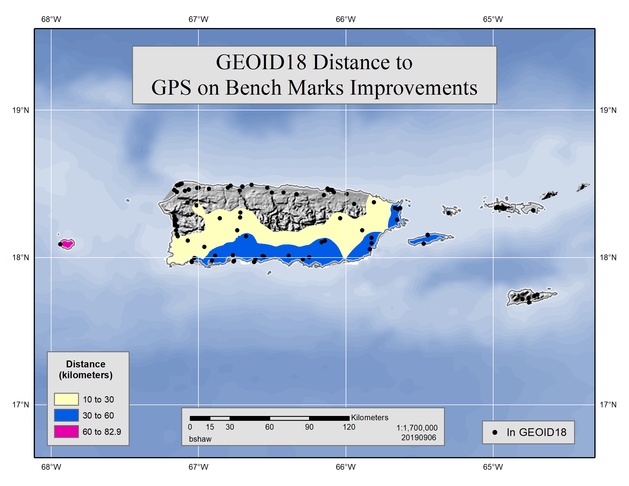
GEOID18 GPS on Bench Marks |
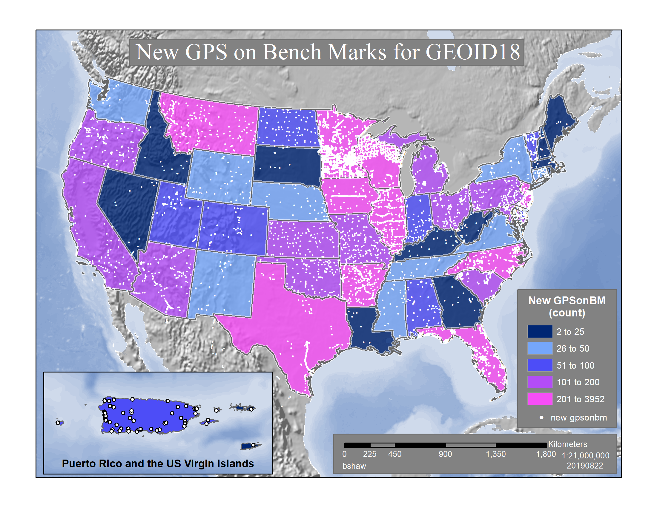
New GPS on Bench Marks for GEOID18 |
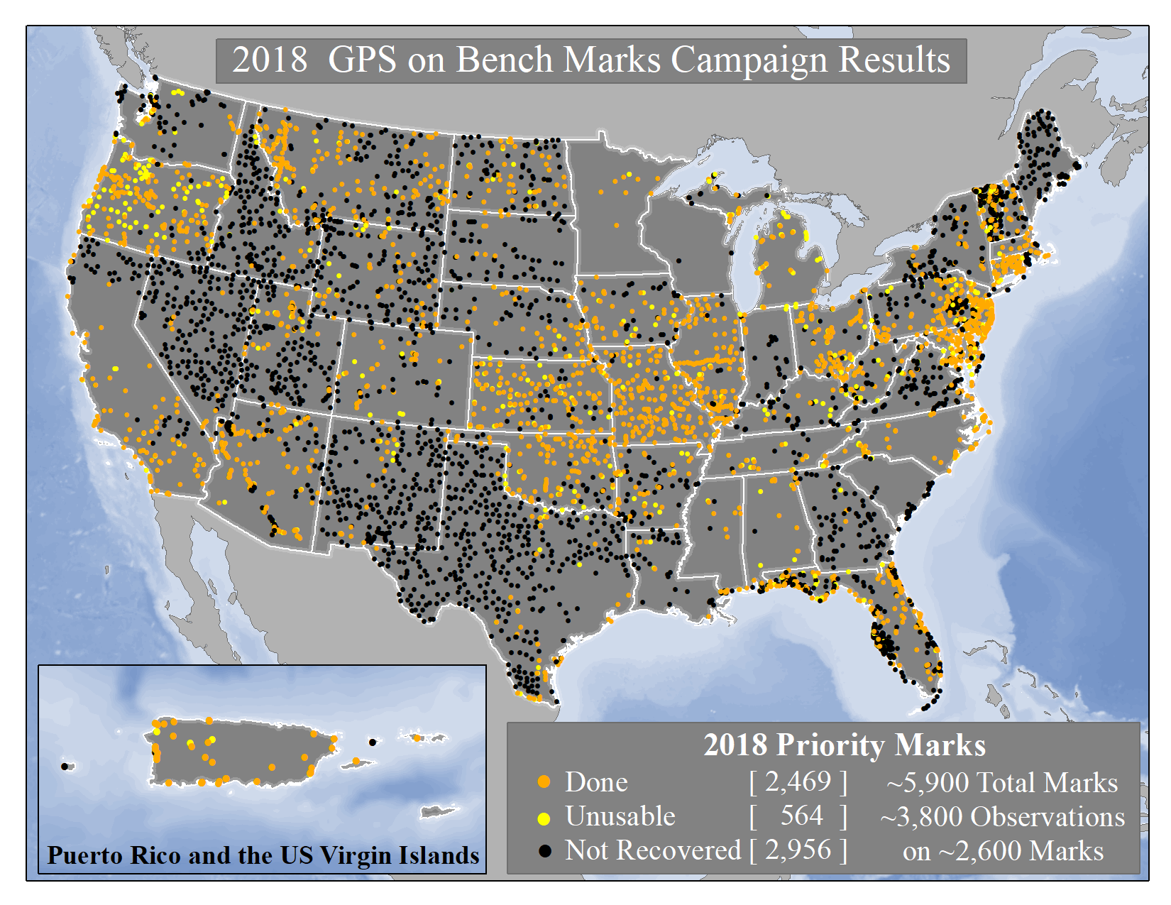
2018 GPS on Bench Marks Campaign Results |
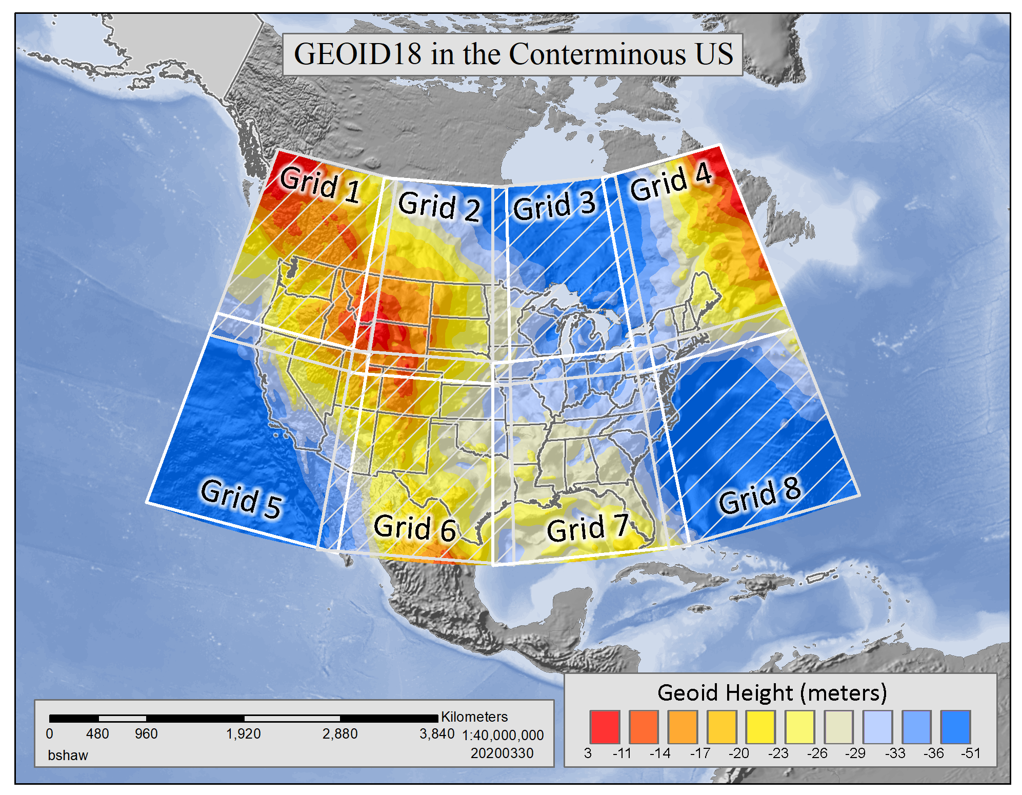
GEOID18 Grid Extents for CONUS |
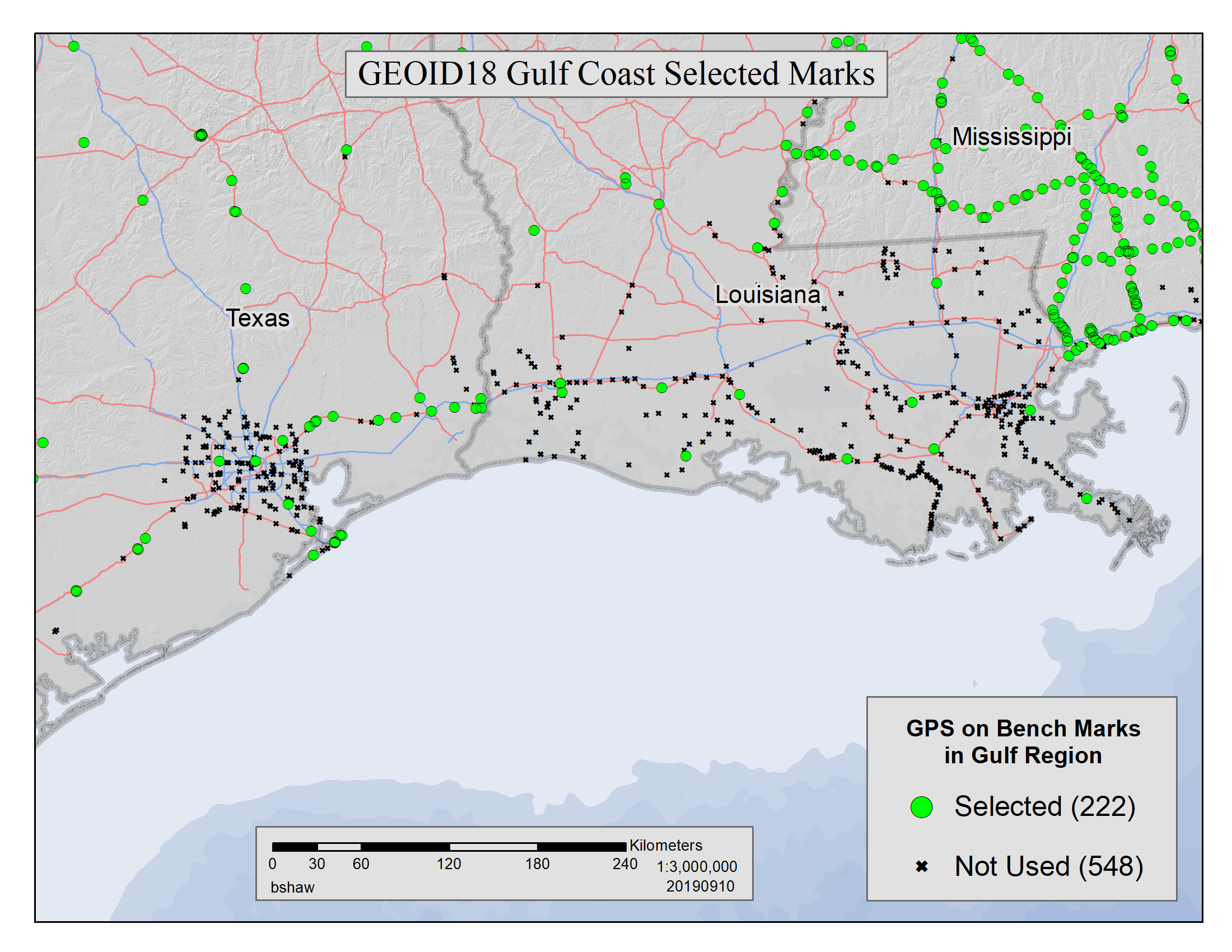
GEOID18 Gulf Coast Selected Marks |
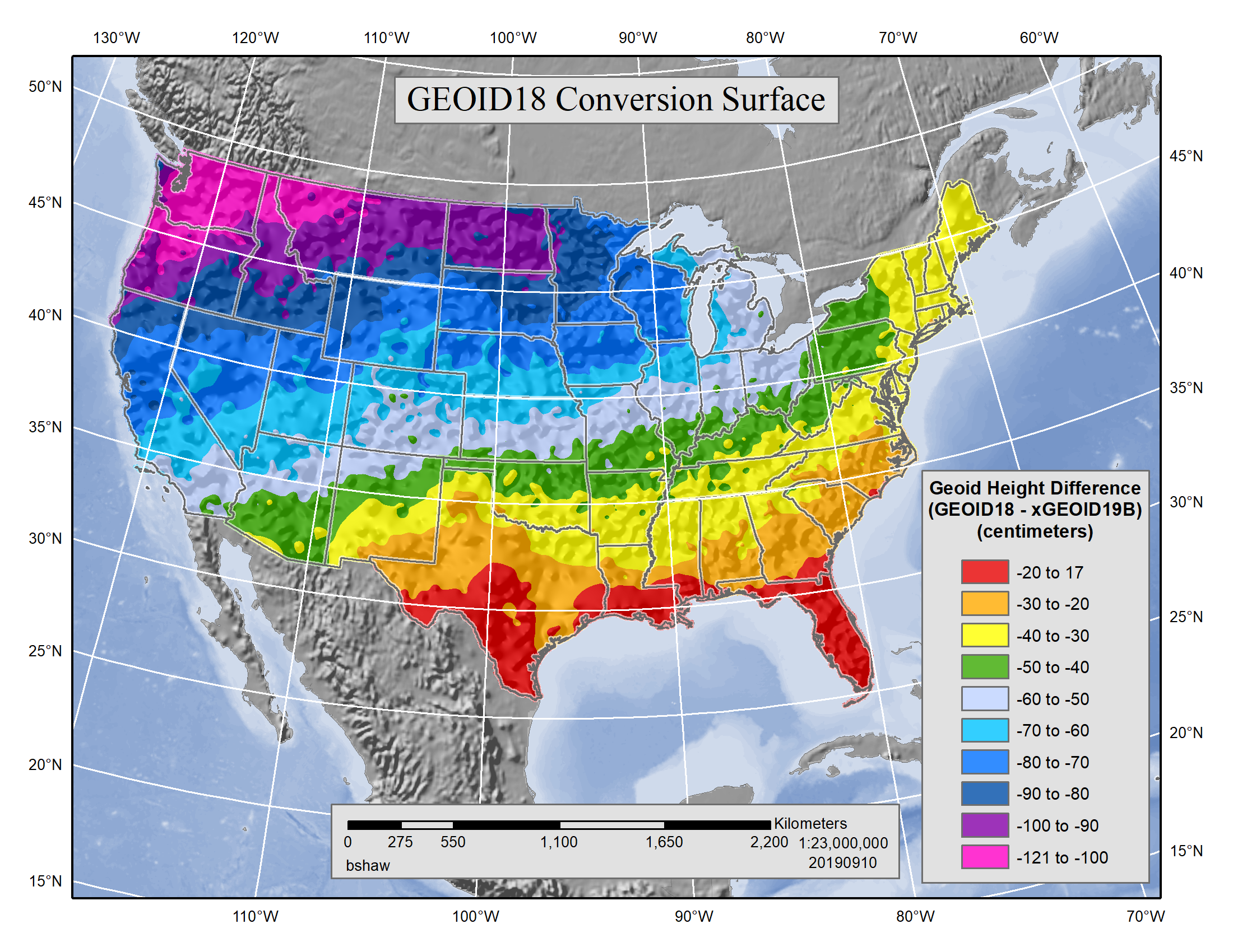
GEOID18-xGEOID19B Conversion Surface
|

