Survey Mark Recovery
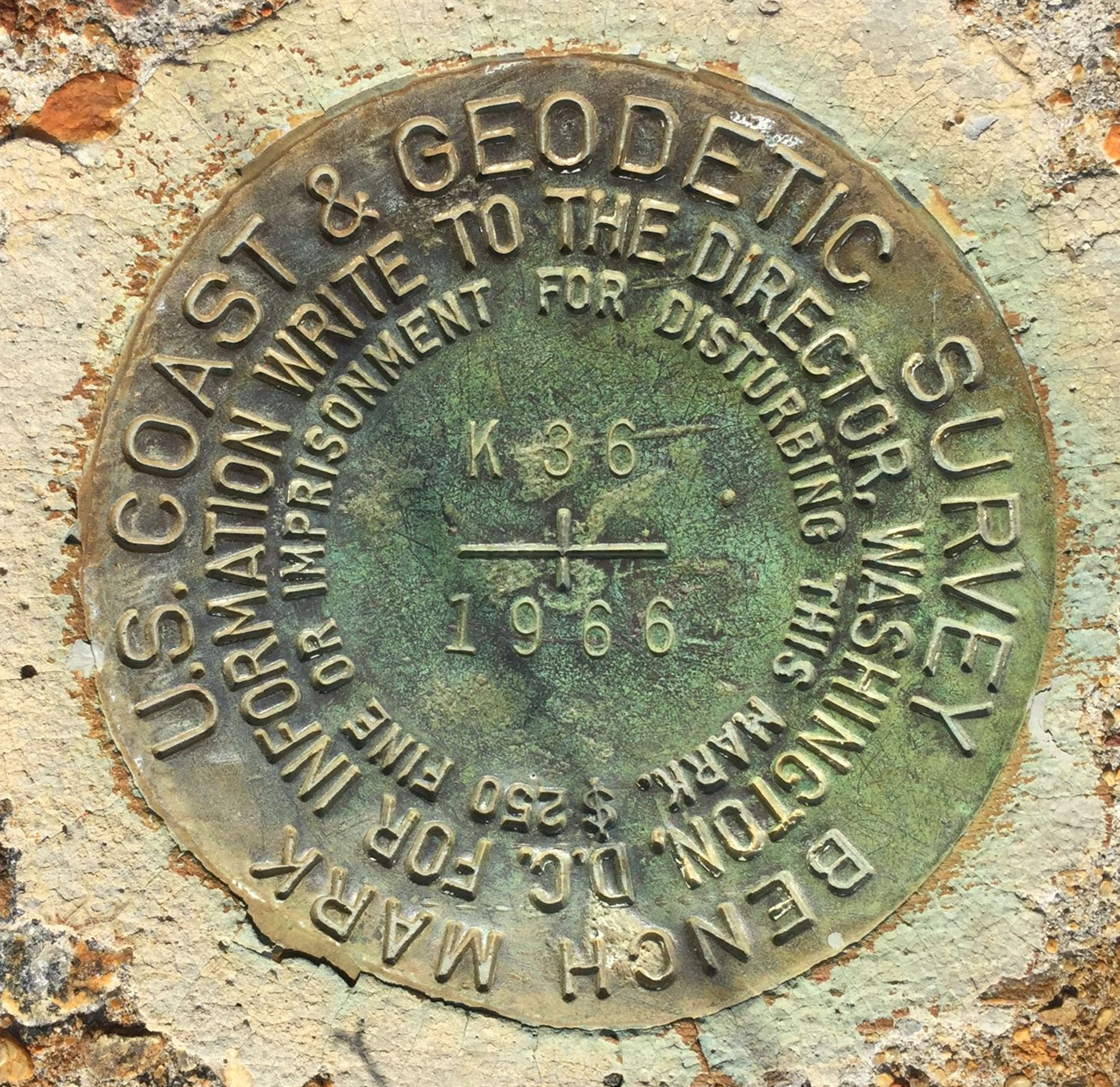
Survey mark refers to any permanent marks or disks placed in the ground or attached to a permanent structure with known latitude, longitude or height information. Its utility depends on the surveyor's ability to recover the mark in good condition. If a mark has been damaged or destroyed, the positional information may have been compromised. If the mark has been completely removed, it's no longer useful.
In an effort to maintain updated records on more than 800,000 survey marks set around the country and its territories, the National Geodetic Survey encourages the public to submit the current mark recovery information.
Submit Survey Mark Recovery Data
To submit your survey mark data to NGS, please use our online Mark Recovery Form.
Mark Recovery Form Instructions:
Mark Recovery Dashboard
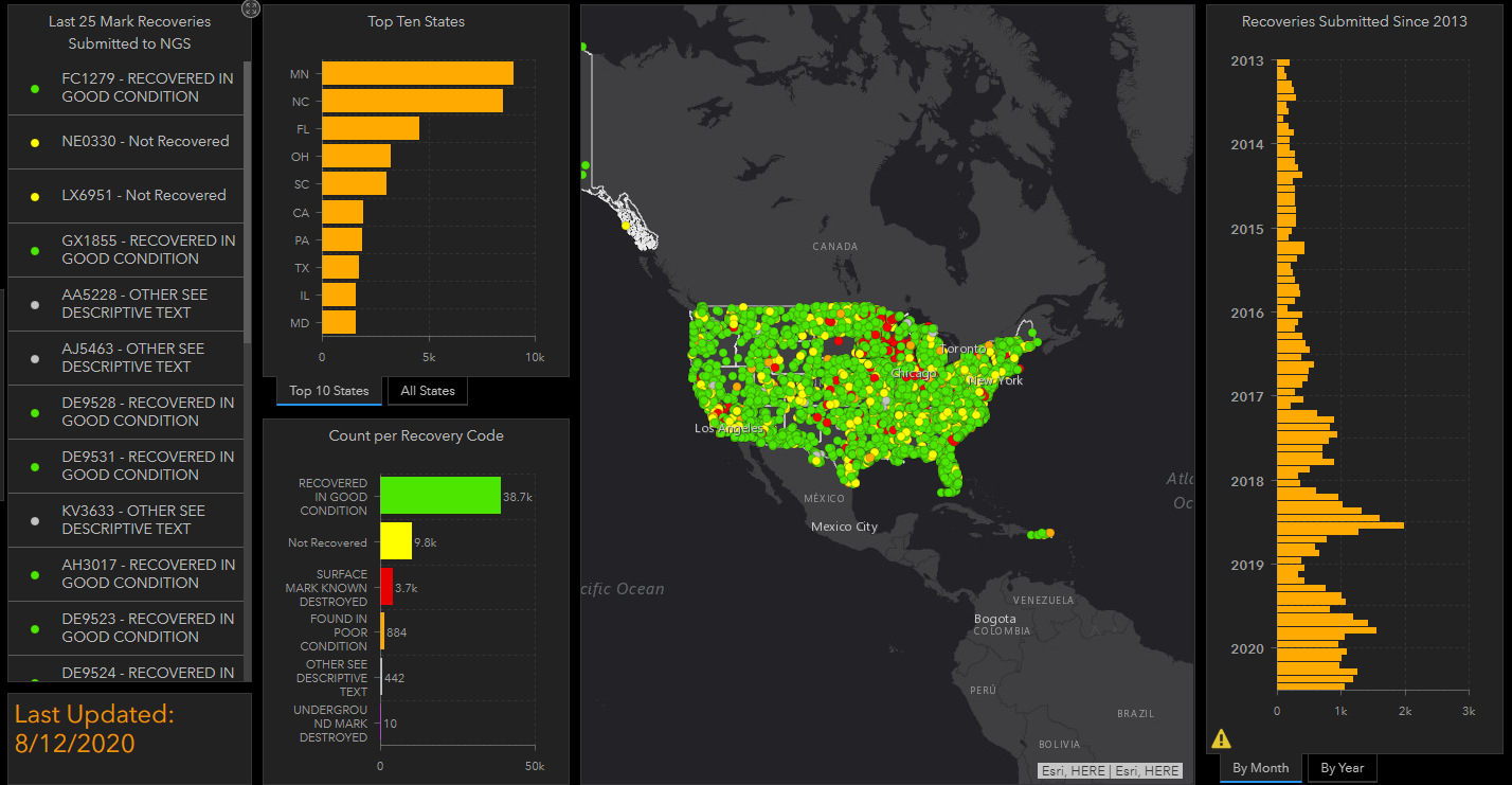
The Mark Recovery Dashboard displays mark recoveries that have been submitted to NGS. The recoveries that are displayed can be queried by several different tools built into the dashboard such as by date and location. The dashboard displays recoveries that have been processed by NGS and ones that are still awaiting approval.
Explore the Mark Recovery Dashboard
For any questions regarding mark recoveries, please contact ngs.mark.updates@noaa.gov.

