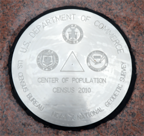
U.S. Center of Population: 2010
Since 1960, the U.S. Census Bureau and NOAA's National Geodetic Survey have worked together to establish a geodetic control mark at or near the computed location of the center of the U.S. population, in commemoration of the completion of each decennial census. In 2010, the center of the U.S. population was near Plato, Missouri.

On May 9, 2011, representatives from NOAA’s National Geodetic Survey and the U.S. Census Bureau revealed the geodetic survey disc commemorating the national center of population, based on the 2010 decennial census. This dedication ceremony attracted townspeople, elected representatives, government officials, and hundreds of students and celebrated Plato, Missouri, as the 2010 Census U.S. center of population.
Each decade after tabulating the decennial census, the Census Bureau calculates the mean center of population for the country, as well as for each state and county. NGS is the U.S. government source for precise latitude, longitude, and elevation measurements and has monumented the national center of population with geodetic survey marks since 1960. This distinction serves a commemorative purpose for the community, as well as a functional reference point for the nation's mapping and charting infrastructure.
- Designation: CENTER OF POPULATION CENSUS 2010
- PID: BBCJ18
- Datasheet: https://www.ngs.noaa.gov/OPUS/getDatasheet.jsp?PID=BBCJ18
- Year: 01-01-2011
- Location: Plato, Missouri
- Latitude/Longitude: 37.50336 / -92.22333
- Event Commemorated: Completion of the 2010 census

