| PID:
|
BBGK17 |
| Designation:
|
877 5241 C |
| Stamping:
|
877 5241 C 2016 |
| Stability:
|
Monument will probably hold position well |
| Setting:
|
Stainless steel rod in sleeve (10FT+ or 3.048M+) |
| Description:
|
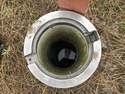
THE MARK IS LOCATED ON SAN JOSE ISLAND, FERRY WILL BE NEEDED TO GET THERE. MARK IS 395.3 FT NW FROM BM B, 283.6 FT NW OF THE NW CORNER OF WOODEN FERRY RAMP, AND 117.2 FT NNE OF CENTER OF JETTY. |
| Observed:
|
2019-02-16T13:18:00Z |
| Source:
|
OPUS - page5 1603.24 |
|
|
|
| Close-up View
|
|
| REF_FRAME:
NAD_83(2011) |
EPOCH:
2010.0000 |
SOURCE:
NAVD88 (Computed using GEOID18) |
UNITS:
m |
SET PROFILE
|
DETAILS
|
|
| LAT:
|
27° 50' 29.48957"
|
± 0.008
m |
| LON:
|
-97° 2' 52.23282"
|
±
0.010
m |
| ELL HT:
|
-25.191 |
±
0.014
m |
| X:
|
-692498.298 |
±
0.011
m |
| Y:
|
-5601275.773 |
±
0.012
m |
| Z:
|
2960975.872 |
±
0.009
m |
| ORTHO HT:
|
1.195 |
±
0.049
m |
|
|
UTM
14 |
SPC
4204(TXSC) |
| NORTHING:
|
3081177.370m |
4002513.156m |
| EASTING:
|
692242.247m |
792327.486m |
| CONVERGENCE:
|
0.91199167°
|
0.95638611°
|
| POINT SCALE:
|
1.00005618 |
1.00019954 |
| COMBINED FACTOR:
|
1.00006014 |
1.00020350 |
|
|
|
|
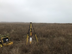
| Horizon View
|
|
|
|
|