| PID:
|
BBFW31 |
| Designation:
|
AL14 B 98 |
| Stamping:
|
AL14 B 98 |
| Stability:
|
Of questionable or unknown reliability |
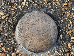
| Setting:
|
Pavement (street, sidewalk, curb, etc.) |
| Mark Condition:
|
G |
| Description:
|
Recovered as described |
| Observed:
|
2023-02-08T13:49:00Z |
more obs 2023-03-13
|
| Source:
|
OPUS - page5 2008.25 |
|
|
|
| Close-up View
|
|
| REF_FRAME:
NAD_83(2011) |
EPOCH:
2010.0000 |
SOURCE:
NAVD88 (Computed using GEOID18) |
UNITS:
m |
SET PROFILE
|
DETAILS
|
|
| LAT:
|
30° 38' 56.05836"
|
± 0.005
m |
| LON:
|
-88° 3' 35.50680"
|
±
0.004
m |
| ELL HT:
|
-26.411 |
±
0.016
m |
| X:
|
185930.431 |
±
0.004
m |
| Y:
|
-5488765.494 |
±
0.013
m |
| Z:
|
3232453.904 |
±
0.009
m |
| ORTHO HT:
|
2.023 |
±
0.055
m |
|
|
UTM
16 |
SPC
102(AL W) |
| NORTHING:
|
3391171.706m |
72065.136m |
| EASTING:
|
398447.449m |
546338.967m |
| CONVERGENCE:
|
-0.54033889°
|
-0.28541111°
|
| POINT SCALE:
|
0.99972722 |
0.99996884 |
| COMBINED FACTOR:
|
0.99973137 |
0.99997299 |
|
|
|
|
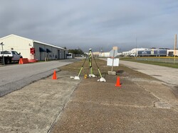
| Horizon View
|
|
|
|
|