| PID:
|
BBFP77 |
| Designation:
|
943 4068 D |
| Stamping:
|
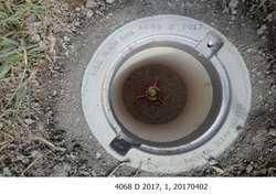
4068 D 2017 |
| Stability:
|
Monument will probably hold position well |
| Setting:
|
Stainless steel rod in sleeve (10FT+ or 3.048M+) |
| Description:
|
The station is a stainless-steel rod set in a gravel pullout 70 m (229.7 ft) west of the Siuslaw River Marina parking area, driven 80 ft to refusal, encased in a NOS logo cover containing magnets with kick block, 35.75 m (117.3 ft) SE of a utility pole numbered 114208, 25.12 m (82.4 ft) SE of the center-line of Highway 126, 19.92 m (65.4 ft) south of a 50 mph speed limit sign and 3.3 m (10.8 ft) NW of the end of the pullout at the river's edge. The datum point is set 15 cm (6 in) below ground. |
| Observed:
|
2017-04-02T02:09:00Z |
| Source:
|
OPUS - page5 1209.04 |
|
|
|
| Close-up View
|
|
| REF_FRAME:
NAD_83(2011) |
EPOCH:
2010.0000 |
SOURCE:
NAVD88 (Computed using GEOID18) |
UNITS:
m |
SET PROFILE
|
DETAILS
|
|
| LAT:
|
43° 58' 53.00072"
|
± 0.008
m |
| LON:
|
-124° 3' 13.23407"
|
±
0.005
m |
| ELL HT:
|
-21.865 |
±
0.011
m |
| X:
|
-2574121.216 |
±
0.003
m |
| Y:
|
-3808590.386 |
±
0.006
m |
| Z:
|
4406588.675 |
±
0.014
m |
| ORTHO HT:
|
2.505 |
±
0.052
m |
|
|
UTM
10 |
SPC
3602(OR S) |
| NORTHING:
|
4870345.384m |
263184.034m |
| EASTING:
|
415495.874m |
1214970.973m |
| CONVERGENCE:
|
-0.73174187°
|
-2.43123815°
|
| POINT SCALE:
|
0.99968783 |
0.99999532 |
| COMBINED FACTOR:
|
0.99969126 |
0.99999875 |
|
|
|
|
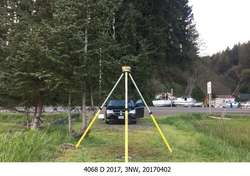
| Horizon View
|
|
|
|
|