| PID:
|
BBFP75 |
| Designation:
|
943 3501 A |
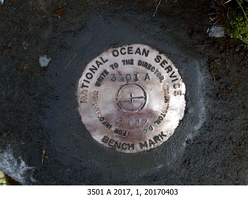
| Stamping:
|
3501 A 2017 |
| Stability:
|
Monument will probably hold position well |
| Setting:
|
Retaining wall or concrete ledge |
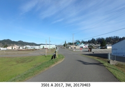
| Description:
|
The bench mark is a disk set in a flood wall, 28.81 m (94.5 ft) South of the SW corner of a warehouse building, 25.87 m (84.9 ft) SE of the West end of flood wall at Gate 4, 18.57 m (60.9 ft) SSE of a stop sign at the corner of Water Street and River Front Way, 2.92 m (9.6 ft) SE of a concrete flood wall break, 0.52 m (1.7 ft) WSW of the edge of pavement of River Front Way, and 0.6 m (2.0 ft) above grade. |
| Observed:
|
2017-04-03T16:21:00Z |
| Source:
|
OPUS - page5 1209.04 |
|
|
|
| Close-up View
|
|
| REF_FRAME:
NAD_83(2011) |
EPOCH:
2010.0000 |
SOURCE:
NAVD88 (Computed using GEOID18) |
UNITS:
m |
SET PROFILE
|
DETAILS
|
|
| LAT:
|
43° 42' 12.88348"
|
± 0.011
m |
| LON:
|
-124° 5' 39.16658"
|
±
0.008
m |
| ELL HT:
|
-19.059 |
±
0.013
m |
| X:
|
-2588801.520 |
±
0.014
m |
| Y:
|
-3824475.884 |
±
0.013
m |
| Z:
|
4384327.788 |
±
0.006
m |
| ORTHO HT:
|
5.776 |
±
0.053
m |
|
|
UTM
10 |
SPC
3602(OR S) |
| NORTHING:
|
4839532.539m |
232485.017m |
| EASTING:
|
411836.617m |
1210397.348m |
| CONVERGENCE:
|
-0.75607043°
|
-2.45897130°
|
| POINT SCALE:
|
0.99969560 |
0.99993817 |
| COMBINED FACTOR:
|
0.99969859 |
0.99994116 |
|
|
|
|
| Horizon View
|
|
|
|
|