| PID:
|
BBFM12 |
| Designation:
|
946 2450 E |
| Stamping:
|
2450 E 2006 |
| Stability:
|
Monument will probably hold position well |
| Setting:
|
Stainless steel rod without sleeve (10FT+ or 3.048M+) |
| Mark Condition:
|
G |
| Description:
|
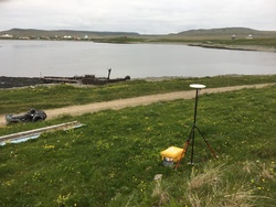
The bench mark is set at the base of a bluff, 187.91 m (616.5 ft) SSE of bench mark 946 2450 D, 157.80 m (517.7 ft) north of bench mark 946 2450 F, 21.00 m (68.9 ft) west of the NW corner of the marine railway, 12.10 m (39.7 ft) south of the SW corner of the 3.70 m x 5.00 m x 3 m (12.1 ft x 16.4 ft x 10 ft) high tide house, and 12.00 m (39.4 ft) west of the centerline of the road. |
| Observed:
|
2017-06-21T05:47:00Z |
more obs 2017-02-24
|
| Source:
|
OPUS - page5 1603.24 |
|
|

|
| Close-up View
|
|
| REF_FRAME:
NAD_83(2011) |
EPOCH:
2010.0000 |
SOURCE:
NAVD88 (Computed using GEOID12B) |
UNITS:
m |
SET PROFILE
|
DETAILS
|
|
| LAT:
|
52° 56' 26.15906"
|
± 0.008
m |
| LON:
|
-168° 52' 16.64821"
|
±
0.007
m |
| ELL HT:
|
18.645 |
±
0.008
m |
| X:
|
-3779536.082 |
±
0.010
m |
| Y:
|
-743482.375 |
±
0.009
m |
| Z:
|
5066577.408 |
±
0.002
m |
| ORTHO HT:
|
5.610 |
±
0.016
m |
|
|
UTM
2 |
SPC
5010(AK10) |
| NORTHING:
|
5867783.735m |
239662.869m |
| EASTING:
|
643045.444m |
1478401.510m |
| CONVERGENCE:
|
1.69901936°
|
5.68102767°
|
| POINT SCALE:
|
0.99985115 |
0.99984969 |
| COMBINED FACTOR:
|
0.99984823 |
0.99984677 |
|
|
|
|
| Horizon View
|
|
|
|
|