| PID:
|
BBFB77 |
| Designation:
|
946 6931 D |
| Stamping:
|
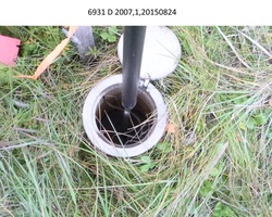
6931 D 2007 |
| Stability:
|
Monument will probably hold position well |
| Setting:
|
Stainless steel rod without sleeve (10FT+ or 3.048M+) |
| Description:
|
The benchmark is a flanged encased rod located NE of the end of the Hooper Bay runway on the south side of the Agulikutaq Slough, 144 m(274 ft) SSW of benchmark 946 6931 C, 92.60 m(303.8 ft) NNE of benchmark 946 6931 E, 34.0 m (111.5 ft) NW of west edge of Kwigilluchuk Creek, and 20.5 m(67.3 ft) east of the east edge of the first pond east of the open ocean. The benchmark is set 10 cm (0.3 ft) below grade, the top of a stainless steel rod driven 13.26 m(43.5 ft) to refusal. |
| Observed:
|
2015-08-24T04:58:00Z |
| Source:
|
OPUS - page5 1209.04 |
|
|
|
| Close-up View
|
|
| REF_FRAME:
NAD_83(2011) |
EPOCH:
2010.0000 |
SOURCE:
NAVD88 (Computed using GEOID12B) |
UNITS:
m |
SET PROFILE
|
DETAILS
|
|
| LAT:
|
61° 31' 45.01937"
|
± 0.004
m |
| LON:
|
-166° 8' 47.65284"
|
±
0.019
m |
| ELL HT:
|
10.712 |
±
0.014
m |
| X:
|
-2959755.335 |
±
0.010
m |
| Y:
|
-729912.872 |
±
0.017
m |
| Z:
|
5583701.460 |
±
0.013
m |
| ORTHO HT:
|
2.561 |
±
0.024
m |
|
|
UTM
3 |
SPC
5008(AK 8) |
| NORTHING:
|
6822267.609m |
838469.924m |
| EASTING:
|
439023.295m |
492202.508m |
| CONVERGENCE:
|
-1.00793468°
|
-0.12884408°
|
| POINT SCALE:
|
0.99964555 |
0.99990074 |
| COMBINED FACTOR:
|
0.99964387 |
0.99989906 |
|
|
|
|
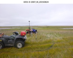
| Horizon View
|
|
|
|
|