| PID:
|
BBDG52 |
| Designation:
|
857 2770 TIDAL 6 |
| Stamping:
|
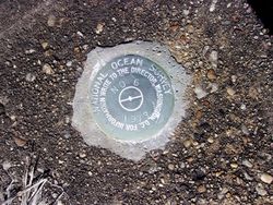
NO 6 1973 |
| Stability:
|
Monument will probably hold position well |
| Setting:
|
Pavement (street, sidewalk, curb, etc.) |
| Mark Condition:
|
G |
| Description:
|
Recovered |
| Observed:
|
2020-03-09T11:59:00Z |
more obs 2020-04-16
|
| Source:
|
OPUS - page5 1801.18 |
|
|
|
| Close-up View
|
|
| REF_FRAME:
NAD_83(2011) |
EPOCH:
2010.0000 |
SOURCE:
NAVD88 (Computed using GEOID18) |
UNITS:
m |
SET PROFILE
|
DETAILS
|
|
| LAT:
|
38° 57' 18.89446"
|
± 0.005
m |
| LON:
|
-76° 21' 15.46045"
|
±
0.005
m |
| ELL HT:
|
-28.987 |
±
0.008
m |
| X:
|
1171667.116 |
±
0.003
m |
| Y:
|
-4826242.974 |
±
0.006
m |
| Z:
|
3988436.643 |
±
0.009
m |
| ORTHO HT:
|
4.601 |
±
0.052
m |
|
|
UTM
18 |
SPC
1900(MD) |
| NORTHING:
|
4312682.502m |
143236.290m |
| EASTING:
|
382653.108m |
455967.137m |
| CONVERGENCE:
|
-0.85156111°
|
0.40526667°
|
| POINT SCALE:
|
0.99976956 |
0.99995081 |
| COMBINED FACTOR:
|
0.99977411 |
0.99995536 |
|
|
|
|
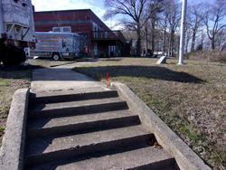
| Horizon View
|
|
|
|
|