| PID:
|
BBCC55 |
| Designation:
|
946 6153 A |
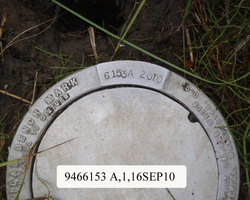
| Stamping:
|
6153 A 2010 |
| Stability:
|
Monument will probably hold position well |
| Setting:
|
Stainless steel rod without sleeve (10FT+ or 3.048M+) |
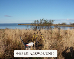
| Description:
|
The station is a stainless steel rod 25.44 m (83.5 ft) NNE of the grass line starting the high water flood plain, 14.52 m (47.6 ft) SE of a cluster of trees, 10.85 m (35.6 ft) NW of another cluster of trees, and 8.59 m (28.2 ft) NNE of a high water debris line. The datum point is the top of a stainless steel rod driven 10.8 m (36.0 ft) to refusal and is set 8 cm (0.30 ft) below the top of a 7-inch National Ocean Service logo cap that is encased in a 6-inch PVC pipe that is set flush with grade. |
| Observed:
|
2010-06-06T04:56:00Z |
more obs Latest
|
| Source:
|
OPUS - page5 1009.28 |
|
|
|
| Close-up View
|
|
| REF_FRAME:
NAD_83(CORS96) |
EPOCH:
2003.0000 |
SOURCE:
NAVD88 (Computed using GEOID09) |
UNITS:
m |
SET PROFILE
|
DETAILS
|
|
| LAT:
|
60° 16' 12.52481"
|
± 0.013
m |
| LON:
|
-162° 24' 34.49941"
|
±
0.025
m |
| ELL HT:
|
14.873 |
±
0.023
m |
| X:
|
-3022738.224 |
±
0.017
m |
| Y:
|
-958312.624 |
±
0.024
m |
| Z:
|
5515477.633 |
±
0.026
m |
| ORTHO HT:
|
3.925 |
±
0.039
m |
|
|
UTM
3 |
SPC
5007(AK 7 ) |
| NORTHING:
|
6684310.712m |
698255.495m |
| EASTING:
|
643283.048m |
477334.209m |
| CONVERGENCE:
|
2.24982741°
|
-0.35567256°
|
| POINT SCALE:
|
0.99985158 |
0.99990629 |
| COMBINED FACTOR:
|
0.99984926 |
0.99990397 |
|
|
|
|
| Horizon View
|
|
|
|
|