| PID:
|
BBBG81 |
| Designation:
|
873 1952 B |
| Stamping:
|
1952 B 1980 |
| Stability:
|
Monument will probably hold position well |
| Setting:
|
Stainless steel rod without sleeve (10FT+ or 3.048M+) |
| Description:
|
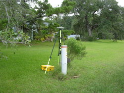
Located about 10.0 miles NW of Gulf Shores, in Bon Secour, on highway right-of-way. To reach from County Road 49 and County Road 10, go south on County road 10 for 1.0 mile to a T intersection and river road. Turn right and go west 0.05 mi to the station on the right.The station is located 25.0 m SW of the SW corner of a residence, 9.0 m N of the centerline of the paved road, 0.3 m N of a 4 foot high utility pole with witness sign. |
| Observed:
|
2009-02-27T13:08:00Z |
more obs Original
|
| Source:
|
OPUS - page5 1209.04 |
|
|

|
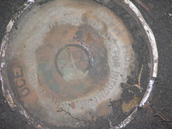
| Close-up View
|
|
| REF_FRAME:
NAD_83(2011) |
EPOCH:
2010.0000 |
SOURCE:
NAVD88 (Computed using GEOID18) |
UNITS:
m |
SET PROFILE
|
DETAILS
|
|
| LAT:
|
30° 18' 9.45396"
|
± 0.009
m |
| LON:
|
-87° 44' 11.40912"
|
±
0.003
m |
| ELL HT:
|
-27.043 |
±
0.021
m |
| X:
|
217673.213 |
±
0.004
m |
| Y:
|
-5507082.632 |
±
0.020
m |
| Z:
|
3199368.744 |
±
0.006
m |
| ORTHO HT:
|
0.650 |
±
0.056
m |
|
|
UTM
16 |
SPC
102(AL W) |
| NORTHING:
|
3352549.218m |
33569.068m |
| EASTING:
|
429181.586m |
577251.789m |
| CONVERGENCE:
|
-0.37163051°
|
-0.11933193°
|
| POINT SCALE:
|
0.99966187 |
0.99993972 |
| COMBINED FACTOR:
|
0.99966612 |
0.99994397 |
|
|
|

|
| Horizon View
|
|
|
|
|