| May 17 2024 |
|
||
|
 |
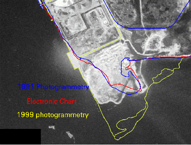
NGS has traditionally used only airborne photography for its mapping missions. However, the advent of high resolution spaceborne imagery may be useful for precision mapping projects. NGS has recently used spaceborne imagery as a reconnaissance tool to evaluate the temporal accuracy of previously compiled shoreline data. |
NGS is experimenting with a wide variety of spaceborne commercial imagery to conduct similar studies of shoreline accuracy. |
|
|
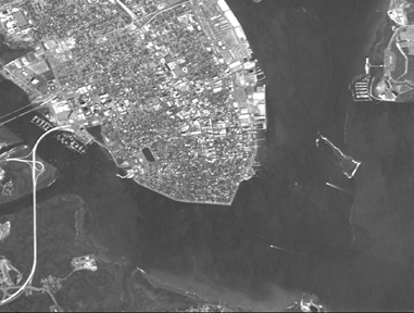
The image at left is a 5 meter resolution
IRS scene taken over Charleston, South Carolina. The imagery was purchased
from Space Imaging
to facilitate research into shoreline mapping using spaceborne data sources.
|
See more information about the Tampa, Florida
project.
|
National Oceanic and Atmospheric
Administration/
National Ocean Service/ National Geodetic Survey Last modified: May 16 2017 |
|