| May 17 2024 |
|
||
|

|
| This experiment is a collaboration between NGS and the National Marine Fisheries Service (NMFS) Habitat Restoration Center, to establish a monitoring plan for the Big Island Sediment Delivery Project. NGS obtained high resolution aerial photography, and collaborated with NASA/JPL, to obtain high resolution AVIRIS hyperspectral imagery of Big Island. Our goal is to obtain similar imagery over repeated epochs to establish a methodology for monitoring the way the island changes over time. |
|
3 Channel composite of Big Island, LA
|
|
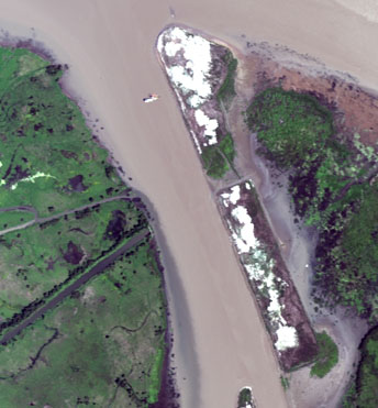
| The scene at left is a 4 meter resolution
3 channel composite of AVIRIS imagery flown on October 27, 1998. The Atchafalaya
River is at the top of the scene and Catfish Pass is at the bottom. The
arrowhead shaped island in the foreground is disposal area #1. A dredge
can be seen in the center of the channel near the top of the scene. The
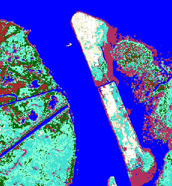
right image is a segmentation designed to classify the coastal environment
into categories of water, wet sand, dry sand, vegetation, and pixels with
mixtures of sand and vegetation. This segmentation was produced using procedures
developed for multispectral data. We have experiments underway to conduct
such segmentations with vector based approaches such as linear demixing,
that are often used with high dimensional (224 channels) hyperspectral
data.
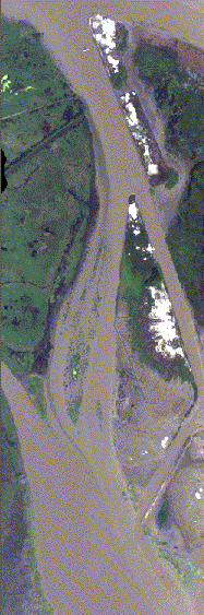
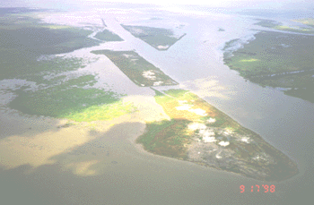
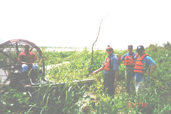
The disposal areas form low lying islands that have very quickly become covered with dense vegetation. The oblique aerial view at below right shows the project 1 month earlier as viewed from above the Atchafalaya River. NOAA scientists and engineers visited the disposal areas by airboat to inspect them prior to the AVIRIS data collection. The lower right image clearly illustrates the density of the vegetation. The larger image at left is an AVIRIS scene depicting the entire Big Island disposal area. Check back soon for information about our research efforts in Coastal Louisiana. |
|
|
AVIRIS scene of Big Island dredge
disposal site
|
Vegetation Density
|
|
National Oceanic and Atmospheric
Administration/
National Ocean Service/ National Geodetic Survey Last modified: May 16 2017 |
|