1. Obtain survey-grade GPS positioning of islands.
2. Obtain targeted benthic
3. Obtain gravimetric data for developing Northwest Hawaii Island geoid.
4. Obtain shallow-water bathymetry for supporting chart development and benthic habitat mapping.
5. Support Hawaii Department of Lands and Natural Resources (DLNR) monitoring activities on Kure.
6. Support National Marine Fisheries Service's (NMFS) monk seal census efforts at Necker and Nihoa.
7. Convene two workshops - One with traditional (surveyors and mappers) and one with non-traditional
(managers and planners) users to discuss to the new National Spatial Reference System
and how to use it.
Partners In Mission:
Office of National Marine Sanctuaries, Office of Coast Survey,
National Centers for Coastal Ocean Service, National Marine Fisheries Service, U.S. Fish
and Wildlife Service, National Ocean Service, National Oceanic and Atmospheric
Administration, National Geodetic Survey, and the University of Hawaii
(top)
Part 1: 04 August - 25 August
1. Arrival in Honolulu no later than August 1.
2. A briefing will be held August 1 to 4 on cruise goals and there will be practice sessions using the equipment.
3. Flight to Midway on August 4.
4. Board the vessel on August 5.
5. Cruise will depart on August 5 or 6.
6. Arrival in Honolulu on August 25 or 26.
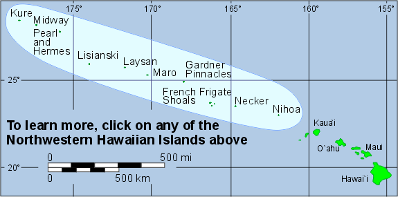
Islands: Kure AToll, Midway Island,
Pearl/Hermes AToll, Lisianski Island,
Laysan Island, Maro Reef (visit 1)
Part 2: 26 August - 14 September
1. Arrival in Honolulu no later thatn
August 22.
2. A briefing will be held on August 23 to 25 or 26 on cruise goals and there
will be practice sessions using the equipment.
3. Board the vessel on August 25 or 26.
4. Cruise will depart on August 27.
5. Arrival in Midway on September 13 or 14.
6. Departure from Midway to Honolulu on September 15.
Islands: Nihoa Island,
Necker Island, French Frigate
Shoals, Gardner Pinnacles, Maro
Reef (visit 2)
(top)
Complete Station List
Map provided courtesy of the Bishop
Museum
| |
 |
|
|
http://www.ngs.noaa.gov/PROJECTS/HawaiiReef/hawaiihome.shtml |
Last Update: Friday, 15-Apr-2011 18:04:39 EDT |
|
For questions or comments on this project, contact Ed Carlson.