OPUS: Online Positioning User Service

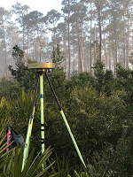
Upload your data file.

Solve your GPS position & tie it to the National Spatial Reference System.
What is OPUS?     FAQs

* data file of dual-frequency GPS observations. sample

antenna - choosing wrong may degrade your accuracy.

meters above your mark.
antenna height of your antenna's reference point.


* email address - your solution will be sent here. Privacy Act Statement

to customize your solution.

formats   formats explained
base stations Use:                 Exclude:
       
identify any CORS you wish to explicitly 'Use' or 'Exclude' from your solution by typing in 4-char site IDs separated with line break
  -- sample
  -- find site IDs
state plane
  your  SPCS zone
project identifier
enter the id provided by your project manager
my profile customize OPUS defaults for future solutions
share my solution sharing explained

for data 15 min. - 2 hrs.       for data 2 hrs. - 48 hrs.


* required fields
We may use your data for internal evaluations of OPUS use, accuracy, or related research.